Map
The map shows every node that shares its position, with your own radio highlighted, over an OpenStreetMap background.
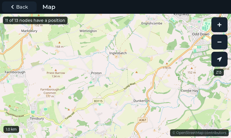
The map, with the nodes of a mesh and your own radio (the larger dot with a white ring).
Opening the Map
Tap Map in the sidebar (next to Chats and Nodes). The map opens full screen; tap Back at the top-left to return.
The first time it opens, the map centres on your nodes at the closest zoom that shows them all. After that it remembers where you left it.
What's on the Map
Nodes are dots in each node's colour, labelled with its short name.
Your radio is a larger dot in the theme's accent colour with a white ring.
The status line (top-left) shows how many of the known nodes have shared a position, for example
3 of 13 nodes have a position.The scale bar (bottom-left) and the zoom level (
Z2toZ17, under the buttons on the right).The map credit (bottom-right), see Map Credit and Licence.
Only nodes that share their position appear. Whether a node shares its position, and how precisely, is set on that node (Meshtastic's position and channel settings). Positions update as the mesh reports them.
Moving Around
Action |
How |
|---|---|
Pan |
Drag the map with one finger |
Zoom in / out |
Tap + or − (one zoom level each) |
Show all nodes |
Tap the arrow button: re-centres on all nodes, at the closest zoom that fits them |
The map wraps around the world east to west.
Node Details
Tap a node to show its card:
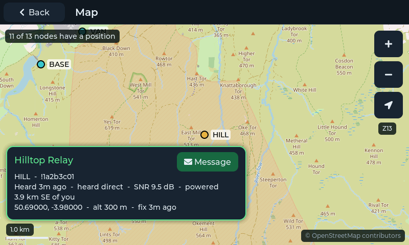
A node's card.
The card shows:
the node's long name, short name and node ID
when it was last heard, how many hops away it is, its signal-to-noise ratio (SNR) and its battery
its distance and direction from you, for example
2.4 km NE of you(needs your own radio's position), or Your radio on your own nodeits coordinates, altitude and GPS fix
Tap Message to open a direct-message conversation with the node. Tap anywhere else on the map to close the card.
Map Backgrounds and Wi-Fi
The map background is downloaded from OpenStreetMap over Wi-Fi as you look around.
Every map tile downloaded is kept on the display (up to about 3 MB) and reused next time, so places you have looked at before appear instantly and are available without Wi-Fi. Tiles are refreshed when they are a few days old.
Without Wi-Fi, or if the map server can't be reached, places you have viewed before still show from the stored copy. Elsewhere the nodes are drawn on a plain grid at their true positions and distances, so the map still works.
Only what you look at is downloaded; MeshDisplay never downloads maps in bulk.
Map Credit and Licence
Map data © OpenStreetMap contributors, available under the Open Database License
(ODbL). The credit © OpenStreetMap contributors is always shown at the
bottom-right of the map; tap it to see the licence details and
openstreetmap.org/copyright. The same notice is in Settings → About.
OpenStreetMap is run by volunteers. TopBytes may move MeshDisplay to another map provider in a software update; the map then looks slightly different but works the same way.